![](/images/other/stat-length.png)
![Excursión Senderismo Gemeinde Seefeld in Tirol - Mösern - Gschwandtkopf - Reith - Photo](https://media.geolcdn.com/t/1900/400/ext.pjpeg?maxdim=2&url=https%3A%2F%2Fservices.sitytrail.com%2FGeolivesWS%2FDownloadMedia.ashx%3FTrailID%3D449994%26Media%3Dfix__20150720142243.jpg)
Mösern - Gschwandtkopf - Reith
VacheKiri67
Usuario
![Longitud](/images/other/stat-length.png)
Longitud
12,7 km
![Altitud máxima](https://static1.geolcdn.com/siteimages/upload/files/1508320355ic_sort_altitude_max_24dp.png)
Altitud máxima
1484 m
![Desnivel positivo](https://static1.geolcdn.com/siteimages/upload/files/1508320355ic_sort_den_pos_24dp.png)
Desnivel positivo
481 m
![Km-Effort](/images/other/stat-length.png)
Km-Effort
19,2 km
![Altitud mínima](https://static1.geolcdn.com/siteimages/upload/files/1508320355ic_sort_altitude_min_24dp.png)
Altitud mínima
1108 m
![Desnivel negativo](https://static1.geolcdn.com/siteimages/upload/files/1508320355ic_sort_den_neg_24dp.png)
Desnivel negativo
488 m
![Boucle](https://static1.geolcdn.com/siteimages/upload/files/16400158638029165_repeat_loop_refresh_sync_direction_icon.png)
Boucle
Sí
Fecha de creación :
2015-07-28 00:00:00.0
Última modificación :
2015-07-28 00:00:00.0
![Senderismo](https://static1.geolcdn.com/sitytour/trail-icons/101.png)
5h02
Dificultad : Medio
![Escanee este código QR para abrir la excursión en la aplicación SityTrail](https://capi.geolives.com/qq0zvz2zws4bq2lad0pu/sitytour/trails/449994/qr.png?size=200)
Aplicación GPS de excursión GRATIS
A propósito
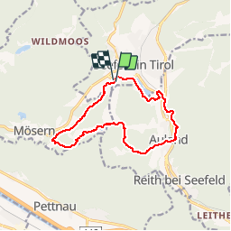
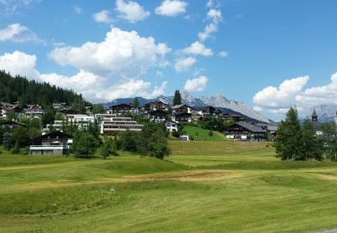
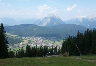
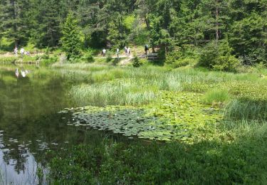
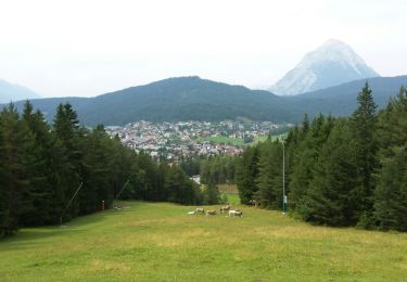
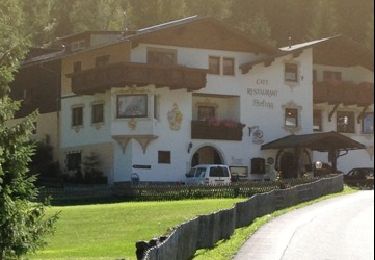
Ruta Senderismo de 12,7 km a descubrir en Tirol, Bezirk Innsbruck-Land, Gemeinde Seefeld in Tirol. Esta ruta ha sido propuesta por VacheKiri67.
Descripción
Faite le 20/07/2015 avec notre fils de 10 ans. Randonnée guidée gratuite proposée par Sport Aktiv et les Hotels de Seefeld.
Localización
País:
Austria
Región :
Tirol
Departamento/provincia :
Bezirk Innsbruck-Land
Municipio :
Gemeinde Seefeld in Tirol
Localidad:
Unknown
Salida:(Dec)
Salida:(UTM)
664725 ; 5243519 (32T) N.
Comentarios
Excursiones cerca
![Excursión Senderismo Gemeinde Seefeld in Tirol - Les hauteurs de Seefeld - Photo](https://media.geolcdn.com/t/375/260/ext.jpg?maxdim=2&url=https%3A%2F%2Fservices.sitytrail.com%2FGeolivesWS%2FDownloadMedia.ashx%3FTrailID%3D608758%26Media%3Dfix__20160730095135.jpg)
![Senderismo Senderismo](https://static1.geolcdn.com/sitytour/trail-icons/101.png)
Les hauteurs de Seefeld
Senderismo
Medio
(1)
Gemeinde Seefeld in Tirol,
Tirol,
Bezirk Innsbruck-Land,
Austria
![](/images/other/stat-length.png)
9,4 km | 14,1 km-effort
4h 37min
![](https://static1.geolcdn.com/siteimages/upload/files/16400158638029165_repeat_loop_refresh_sync_direction_icon.png)
No
![Excursión Senderismo Gemeinde Seefeld in Tirol - Seefelder Spitze et pied de la Reither Spitze - Photo](https://media.geolcdn.com/t/375/260/ext.jpg?maxdim=2&url=https%3A%2F%2Fservices.sitytrail.com%2FGeolivesWS%2FDownloadMedia.ashx%3FTrailID%3D449997%26Media%3Dfix__20150722134415.jpg)
![Senderismo Senderismo](https://static1.geolcdn.com/sitytour/trail-icons/101.png)
Seefelder Spitze et pied de la Reither Spitze
Senderismo
Difícil
(2)
Gemeinde Seefeld in Tirol,
Tirol,
Bezirk Innsbruck-Land,
Austria
![](/images/other/stat-length.png)
9,8 km | 18,2 km-effort
4h 53min
![](https://static1.geolcdn.com/siteimages/upload/files/16400158638029165_repeat_loop_refresh_sync_direction_icon.png)
No
![Excursión Senderismo Gemeinde Seefeld in Tirol - Les lacs - Wildmoos - Möserersee - Photo](https://media.geolcdn.com/t/375/260/ext.jpg?maxdim=2&url=https%3A%2F%2Fservices.sitytrail.com%2FGeolivesWS%2FDownloadMedia.ashx%3FTrailID%3D449996%26Media%3Dfix__20150721150101.jpg)
![Senderismo Senderismo](https://static1.geolcdn.com/sitytour/trail-icons/101.png)
Les lacs - Wildmoos - Möserersee
Senderismo
Fácil
(1)
Gemeinde Seefeld in Tirol,
Tirol,
Bezirk Innsbruck-Land,
Austria
![](/images/other/stat-length.png)
13,7 km | 18,4 km-effort
5h 31min
![](https://static1.geolcdn.com/siteimages/upload/files/16400158638029165_repeat_loop_refresh_sync_direction_icon.png)
Sí
![Excursión Senderismo Gemeinde Seefeld in Tirol - Seefelder Spitze - Photo](https://media.geolcdn.com/t/375/260/ext.jpg?maxdim=2&url=https%3A%2F%2Fservices.sitytrail.com%2FGeolivesWS%2FDownloadMedia.ashx%3FTrailID%3D449993%26Media%3Dfix__20150719120459.jpg)
![Senderismo Senderismo](https://static1.geolcdn.com/sitytour/trail-icons/101.png)
Seefelder Spitze
Senderismo
Difícil
(1)
Gemeinde Seefeld in Tirol,
Tirol,
Bezirk Innsbruck-Land,
Austria
![](/images/other/stat-length.png)
8,3 km | 13,2 km-effort
4h 49min
![](https://static1.geolcdn.com/siteimages/upload/files/16400158638029165_repeat_loop_refresh_sync_direction_icon.png)
No
![Excursión Senderismo Gemeinde Seefeld in Tirol - Randonnée des 3 lacs sur le plateau de Seefeld - Photo](https://media.geolcdn.com/t/375/260/ext.jpg?maxdim=2&url=https%3A%2F%2Fservices.sitytrail.com%2FGeolivesWS%2FDownloadMedia.ashx%3FTrailID%3D617419%26Media%3Dfix__20160726123716.jpg)
![Senderismo Senderismo](https://static1.geolcdn.com/sitytour/trail-icons/101.png)
Randonnée des 3 lacs sur le plateau de Seefeld
Senderismo
Medio
(1)
Gemeinde Seefeld in Tirol,
Tirol,
Bezirk Innsbruck-Land,
Austria
![](/images/other/stat-length.png)
13,6 km | 18 km-effort
5h 28min
![](https://static1.geolcdn.com/siteimages/upload/files/16400158638029165_repeat_loop_refresh_sync_direction_icon.png)
Sí
![Excursión Senderismo Gemeinde Seefeld in Tirol - Reitherjoch Alm - Photo](https://media.geolcdn.com/t/375/260/ext.jpg?maxdim=2&url=https%3A%2F%2Fservices.sitytrail.com%2FGeolivesWS%2FDownloadMedia.ashx%3FTrailID%3D451645%26Media%3Dfix__20150724123821.jpg)
![Senderismo Senderismo](https://static1.geolcdn.com/sitytour/trail-icons/101.png)
Reitherjoch Alm
Senderismo
Medio
(1)
Gemeinde Seefeld in Tirol,
Tirol,
Bezirk Innsbruck-Land,
Austria
![](/images/other/stat-length.png)
8,4 km | 13 km-effort
3h 52min
![](https://static1.geolcdn.com/siteimages/upload/files/16400158638029165_repeat_loop_refresh_sync_direction_icon.png)
Sí
![Excursión Senderismo Gemeinde Seefeld in Tirol - Mittenwald - Leutasch 210813 - Photo](https://media.geolcdn.com/t/375/260/ext.jpg?maxdim=2&url=https%3A%2F%2Fservices.sitytrail.com%2FGeolivesWS%2FDownloadMedia.ashx%3FTrailID%3D215904%26Media%3D20130822153056.jpg)
![Senderismo Senderismo](https://static1.geolcdn.com/sitytour/trail-icons/101.png)
Mittenwald - Leutasch 210813
Senderismo
Muy fácil
Gemeinde Seefeld in Tirol,
Tirol,
Bezirk Innsbruck-Land,
Austria
![](/images/other/stat-length.png)
23 km | 31 km-effort
6h 17min
![](https://static1.geolcdn.com/siteimages/upload/files/16400158638029165_repeat_loop_refresh_sync_direction_icon.png)
No
![Excursión Senderismo Gemeinde Seefeld in Tirol - W32_jpb - Photo](https://media.geolcdn.com/t/375/260/6faa25ae-6519-4505-b697-15ea2f8a3e70.jpg&format=jpg&maxdim=2)
![Senderismo Senderismo](https://static1.geolcdn.com/sitytour/trail-icons/101.png)
W32_jpb
Senderismo
Difícil
Gemeinde Seefeld in Tirol,
Tirol,
Bezirk Innsbruck-Land,
Austria
![](/images/other/stat-length.png)
11,7 km | 16,2 km-effort
3h 52min
![](https://static1.geolcdn.com/siteimages/upload/files/16400158638029165_repeat_loop_refresh_sync_direction_icon.png)
Sí
![Excursión Senderismo Gemeinde Seefeld in Tirol - W3_bis - Photo](https://media.geolcdn.com/t/375/260/76c4e144-8256-4257-8939-f7661079cbd3.jpg&format=jpg&maxdim=2)
![Senderismo Senderismo](https://static1.geolcdn.com/sitytour/trail-icons/101.png)
W3_bis
Senderismo
Medio
Gemeinde Seefeld in Tirol,
Tirol,
Bezirk Innsbruck-Land,
Austria
![](/images/other/stat-length.png)
9,7 km | 13,1 km-effort
3h 11min
![](https://static1.geolcdn.com/siteimages/upload/files/16400158638029165_repeat_loop_refresh_sync_direction_icon.png)
No
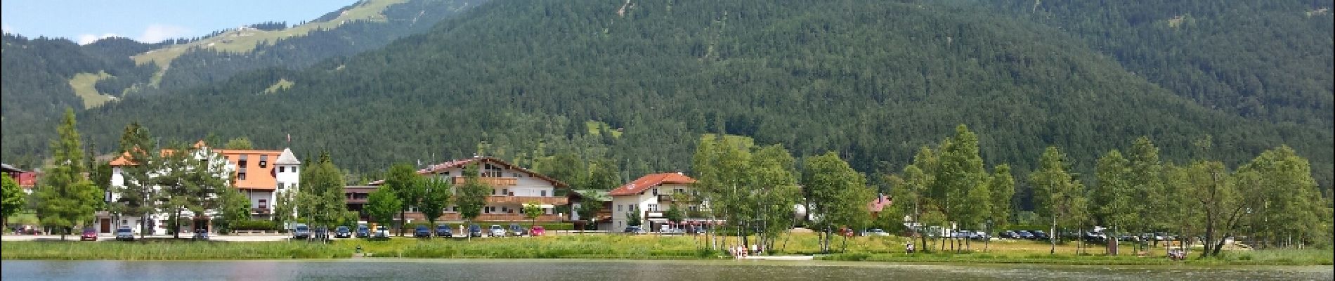
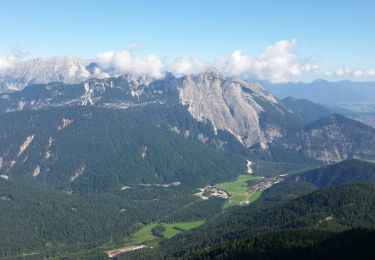
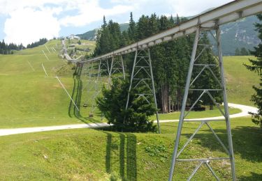
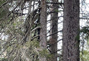
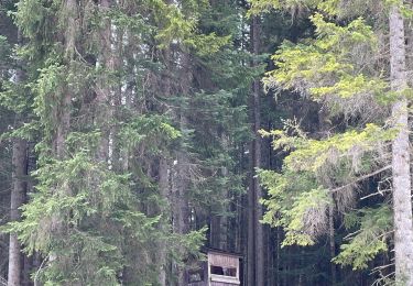
Découverte de Seefeld.